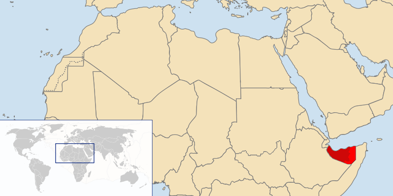
Fisye:LocationSomaliland3.png
LocationSomaliland3.png (798 × 398 pixels, file size: 95 KB, MIME type: image/png)
File history
Click on a date/time to view the file as it appeared at that time.
| Kilumbu/Ngûnga | Thumbnail | Dimensions | Sadi | Comment | |
|---|---|---|---|---|---|
| bubu yayi | 11:44, 29 ngôida ya kûmi na zôle 2023 |  | 798 × 398 (95 KB) | Siirski | Reverted to version as of 23:06, 26 August 2021 (UTC) |
| 19:31, 1 ngônda ya kûmi 2023 |  | 798 × 398 (101 KB) | Caawiyahaderon | https://www.thehindu.com/news/international/pro-somalia-militia-takes-key-army-base-in-breakaway-region/article67238670.ece | |
| 23:06, 26 ngônda ya nâna 2021 |  | 798 × 398 (95 KB) | Siirski | Reverted to version as of 14:11, 29 January 2012 (UTC) | |
| 14:19, 26 ngônda ya nâna 2021 |  | 800 × 399 (75 KB) | Siirski | Reverted to version as of 11:45, 19 July 2007 (UTC) | |
| 14:11, 29 ngônda ya ntete 2012 |  | 798 × 398 (95 KB) | Nicolay Sidorov | fix border | |
| 08:22, 21 ngônda ya nsambwâdi 2011 |  | 798 × 398 (75 KB) | Nicolay Sidorov | highlighted | |
| 22:44, 13 ngônda ya zôle 2011 |  | 798 × 398 (69 KB) | Ras67 | cropped and squeezed | |
| 15:44, 11 ngônda ya ntete 2011 |  | 800 × 399 (95 KB) | Nicolay Sidorov | Southern Sudan is already de-facto independent. | |
| 17:36, 27 ngôida ya kûmi na zôle 2010 |  | 800 × 399 (75 KB) | Nicolay Sidorov | Обозначать де-факто границу Сомалиленда нет смысла, поскольку это государство уже почти полностью контролирует свою территорию | |
| 09:19, 7 ngônda ya kûmi na mosi 2010 |  | 800 × 399 (75 KB) | Nicolay Sidorov | Изменил фактическую границу в соответствии с состоянием дел на 2010 год (http://en.wikipedia.org/wiki/File:Somalia_map_states_regions_districts.png) |
File usage
The following page uses this file:
Global file usage
The following other wikis use this file:
- Usage on af.wikipedia.org
- Usage on an.wikipedia.org
- Usage on ba.wikipedia.org
- Usage on be-tarask.wikipedia.org
- Usage on be.wikipedia.org
- Usage on bn.wikipedia.org
- Usage on br.wikipedia.org
- Usage on cs.wikipedia.org
- Usage on da.wikipedia.org
- Usage on de.wikipedia.org
- Usage on en.wikipedia.org
- Usage on eo.wikipedia.org
- Usage on gag.wikipedia.org
- Usage on id.wikipedia.org
- Usage on ln.wikipedia.org
- Usage on mk.wikipedia.org
- Usage on ml.wikipedia.org
- Usage on mr.wikipedia.org
- Usage on ms.wikipedia.org
- Usage on no.wikipedia.org
- Usage on oc.wikipedia.org
- Usage on pl.wikipedia.org
- Usage on pl.wiktionary.org
- Usage on pnb.wikipedia.org
- Usage on pt.wikipedia.org
- Usage on ro.wikipedia.org
- Usage on ru.wikipedia.org
- Usage on ru.wikinews.org
- Usage on sk.wikipedia.org
- Usage on tk.wikipedia.org
- Usage on tr.wikipedia.org
- Usage on uk.wikipedia.org
- Usage on vi.wikipedia.org

